The Tokyo subway system is not just the oldest in Asia, it also rivals the famous train system for effectiveness and efficiency. But which lines are there? And how do you find the stations? Read on to find out.
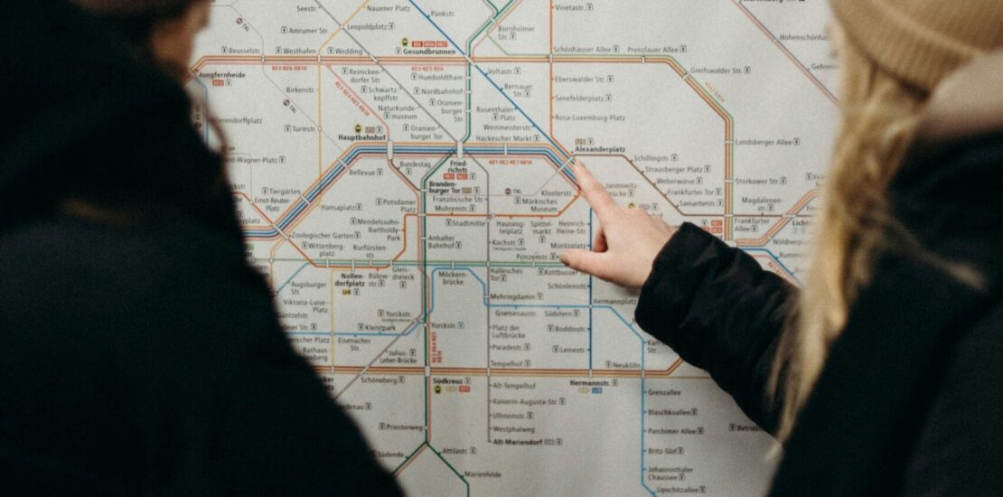
The Tokyo subway network is even more confusing than the train lines around Tokyo — not because the lines are complicated in themselves, but because the subway network in reality extends to the many private train lines that bring passengers from the suburbs into the center.
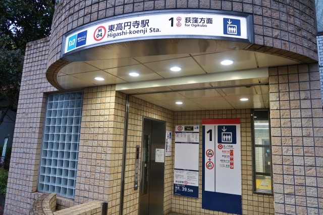
A typical subway entrance in the nearby suburbs.
Where you used to be confined to the nearby suburbs if you were traveling on the subway, now you can go from the northern and western reaches of the Kanto region to the eastern coast of Tokyo Bay or the southern harbor of Yokohama and the castle town of Odawara.
And not only that. When taking the combination of the right private trains and subways, you can now go straight from Narita Airport to Haneda Airport, the other international airport serving Tokyo.
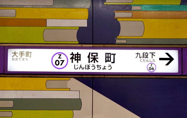
Asakusa Line — The Interconnection Line
Running through the center of old Edo culture, but also past Tokyo Station, the Asakusa line (a reddish pink color on the subway maps) is the line that connects the Haneda and Narita airports. From Asakusa, trains run north on the Keisei line tracks to Narita; from Sengakuji, trains run south on the Keikyu line tracks to Haneda. The line actually continues further south, but that part sees few foreign travelers.
Chiyoda Line — The Subway To Hakone
Marked green on subway maps, this line runs from the southwest to the northeast of central Tokyo, with a rare case of trains continuing on the JR lines towards Abiko in Chiba. In the southwestern direction, the trains interoperate with the Odakyu Line, whose Romancecars are used to provide service to morning commuters, and also through service to the hot spring town of Hakone.
The Fukintoshin line is the newest of the Tokyo subway line.
Fukintoshin Line — Yamanote Line Offload
The Fukintoshin line is marked with a chestnut brown color on subway maps and runs in parallel with the western edge of the Yamanote line, the train ring line around Tokyo. It was created especially to offload the section of the Yamanote line from Ikebukuro to Shibuya, one of the busiest train lines in the world. But trains continue all the way to Yokohama in the south, and Chichibu in the western Saitama mountains, on the Seibu line.
Many stations on the Ginza line lack English text on the signs.
Ginza Line — The Oldest Subway In Asia
The Ginza line became the first subway line in East Asia when it opened in 1927, albeit a lot shorter than today’s route from Ueno to Shibuya. The trains do not connect to other lines.
Hibiya Line — Through Central Tokyo
The Hibiya line is shown using a grey or silver color on subway maps and runs from Naka-Meguro in the south to Kita-Senju in the north, although thanks to interconnections with private railways (including the Tobu Sky Tree line) the trains run much further to the north and south. Make sure to get on the right train if you are passing Kita-Senju, as you may end up miles from your destination if you happen in the wrong branch.
The Hanzomon line has station signs in a purplish color.
Hanzomon Line — The Shortest Subway Line
It is formally the shortest of the subway lines in Tokyo, shown on maps as a lavender-purple color. But thanks to interoperating agreements, the trains continue into the Kanagawa prefecture from Shibuya, and northern Saitama on the Tobu Skytree Line by connecting to Oshiage. The line is named for one of the gates of the Imperial Palace, in turn named for a samurai who helped found the shogunate in the 17th century.
The Maronouchi Line has exchanges with several other lines.
Maronouchi Line — From The Suburbs To The Center
The Maronouchi Line, marked in red on subway maps, runs from the suburb of Ogikubo in the west to the Maronouchi business district between the Imperial Palace and the Tokyo Station and then loops back to the northwest until it gets to Ikebukuro. There is no interconnection with private railway lines, but plenty of exchanges both with other subway lines and the JR train lines.
Mita Line — The Shared Subway Line
The Mita Line, shown in blue on subway maps, runs from Meguro in the south to Nishi-Takashimadaira in the north, with trains continuing south on private railway tracks from Meguro. The northern part of the line is uniquely shared with another subway line, the Namboku Line.
Namboku-sen — From North To South
Shown as a greenish color (formally called emerald) on subway maps, this line runs from Meguro in the south to Akabane-Iwabuchi in the north, passing through central Tokyo on the way. There are interconnections to other railways in both the south and north, making the line end in Urawa-Misono in central Saitama.
Since the Oedo line passes under large parts of Tokyo, there are many exchange stations with other lines.
Oedo Line — Around Old Edo
The Oedo line, shown in magenta-reddish on subway maps, is a ring line running at the outer edges of old Edo, with a spur running off towards the newer housing developments in Nerima at the Tokyo central city office. It is quite convenient for many sights, but stations are separated from exchange stations with other subway lines since the line uses purpose-built trains and tunnels.
Shinjuku Line — From Shinjuku To The East
On subway maps, it is shown a light (or leaf) green. The main terminus is in Shinjuku, the other in Chiba; but at Shinjuku, the trains continue on the Keio line tracks to the west.
This is the only other line in the Tokyo subway network that runs to Chiba, in this case, Nishi-Funabashi. It is shown in a light blue color on subway maps. The other terminus is in Nakano to the west, making this line one of a few that crosses Tokyo from east to west. It is also the only subway line that interoperates with the JR lines (the Chuo-Sobu line, which shares part of the beginning and end of the lines).
Yurakucho Line — Under Central Tokyo
The station after (or before) Tokyo Station on the Yamanote Line is Yurakucho, next to Ginza, and this is what the line is named for. The color used for it on subway maps is supposed to be gold, but in reality turns out to be a yellowish brown. It runs from Wakoshi in the north to Shin-Kiba on Tokyo Bay in the south, zigzagging its way under central Tokyo to get there. There is also continuous traffic on the Seibu lines.
Stay tuned for more exciting content like this! Follow us on our social media platforms and check out our blog regularly to stay updated on the latest news, trends, and insider stories from Japan. Don’t miss out on future updates—sign up for our newsletter for exclusive content delivered straight to your inbox!
Wisterian Watertree
Wisterian Watertree has been living in Tokyo and other Japanese cities for
the past 20 years, helping visitors get the best of Japan. He is the author of two
books, ”Take Your Toddlers To Tokyo” and ”Driving In Japan”, with more on the
way. You can read more on his website Japan Top 10, https://japan-top-10.com.