The trains in Tokyo are easy to find. The subway often less so, but the Tokyo
subway will take you places where the trains do not go. Here is how to find the
stations, make sure you know which entrance to use, and how to navigate once
inside.

The trains in Tokyo are easy to find. The subway often less so, but the Tokyo
subway will take you places where the trains do not go. Here is how to find the
stations, make sure you know which entrance to use, and how to navigate once
inside.
Tokyo has a very extensive subway system. As a matter of fact, it has two. But nobody notices that there are two different companies managing the subway nowadays, and in practice, the only time is when you go to the Oedo line in Roppongi station and have to buy another ticket than for the Hibiya line you came with. But since most people use Suica or Pasmo, they never notice – the interoperation between the two subway systems is handled automatically, just like when they change to the JR lines at one of the big stations like Tokyo Station, Shinjuku, Ikebukuro, Ueno, or Shibuya.
The subway lines go where the main JR lines do not go. But that does not mean there is a grid of subway lines and trains. Since the train lines grew organically in the spaces available to them when Japan started building trains in the 19th century, the Chuo line runs on top of the old Edo Castle moat earthworks; and the Keihin-Tohoku Line runs where there were mud flats before Tokyo started to grow.
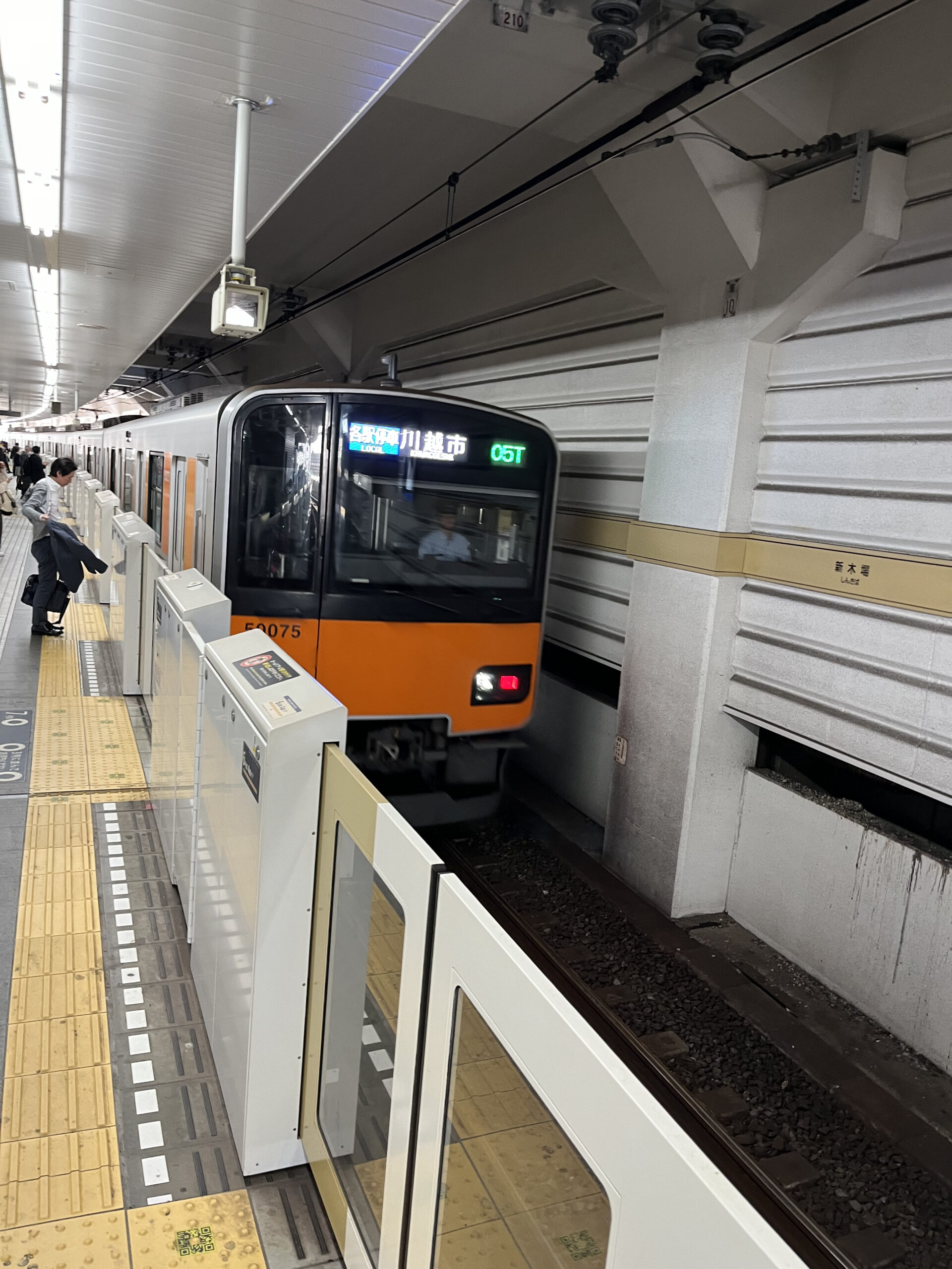
The subway, of course, runs mostly under ground – but when the lines leave the center of Tokyo, they often go above ground. And many of them do not stop there.
Since Tokyo Metro has connected the subway system to the private railways, can commuters take one train even from remote suburbs. And tourists can go all the way from Shibuya directly to Yokohama Chinatown, Shin-Kiba to Chichibu, or Hanzomon station to Kuki in Saitama. The private railway companies run express trains on the subway lines which have brought the suburbs of Tokyo even closer to the Tokyo central business district.
But to use the subway stations to go out into the suburbs, whether you are a public servant toiling away in the government offices of Nagatacho, or a tourist trying to get around the city without squeezing into the always crowded Yamanote line trains, you have two problems: Finding the stations, and getting onto the tracks.
The train stations of Tokyo are easy to find. After all, if they are built on the railway tracks, which you can usually see (sometimes even so ubiquitous that they are running in tunnels on multiple levels because there is no space for the tracks). But the subways almost always (with some minor exceptions) run invisibly in tunnels.
So how do you know where the stations are? And as importantly, which lines they belong to? In Tokyo, a 200-meter walk can save you a major detour, since the interchange stations are far apart, but lines often run in parallel.
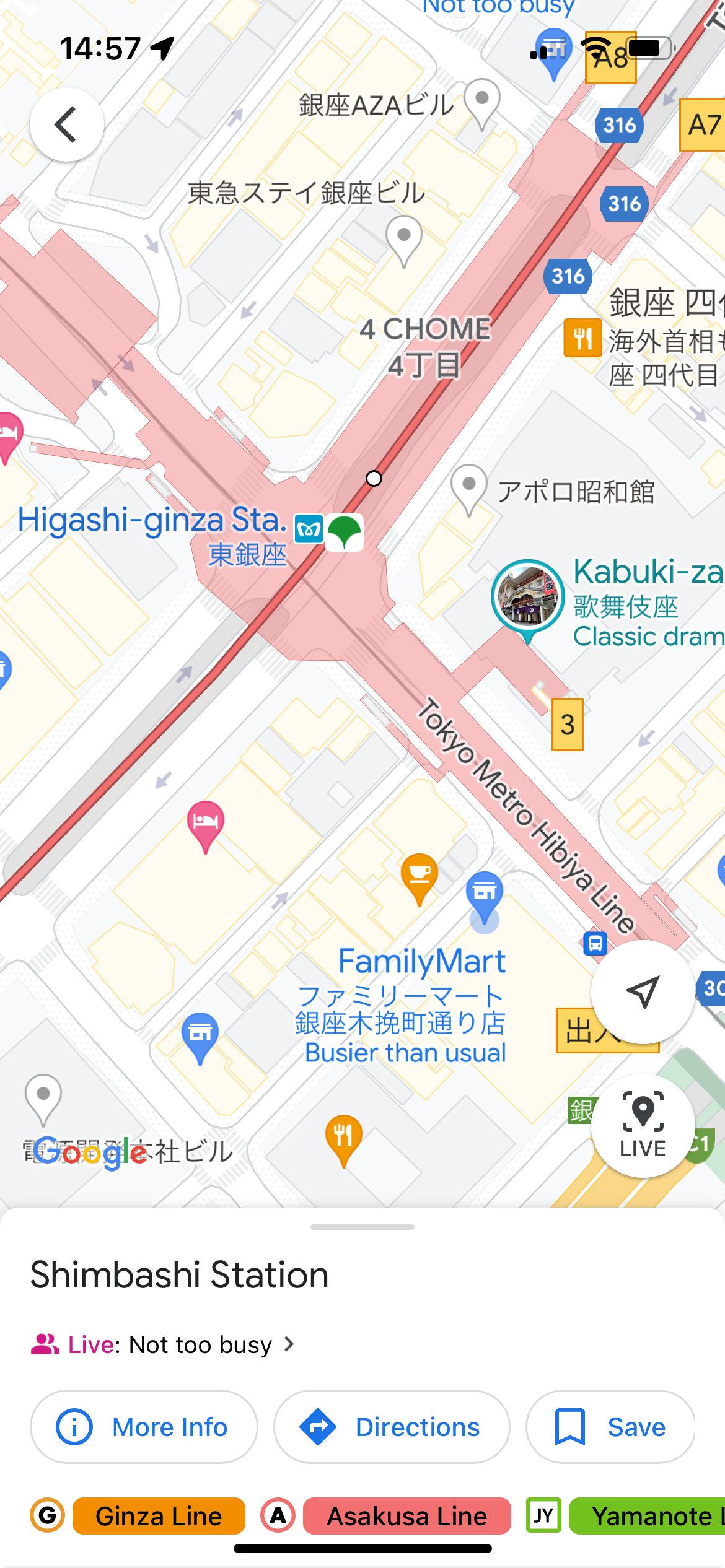
Google Maps to the rescue! Other map applications, such as Apple Maps and Navitime (the homegrown Japanese map and navigation app available in English as Japan Travel) also have the same information, but since I personally use Google Maps to navigate Tokyo, this is what I will use as an example.
When you are looking for a subway station in Tokyo, you can do it in two ways: just look for a Tokyo subway station near you, or look for a station on a specific Tokyo subway line.

If your feet are tired and you do not want to walk any more, you may not care that the subway station is on a specific line, as long as it is close. But if you are planning to go to a specific destination, the way you will search for stations will be very different.
To look for a station near you, just zoom out until you see one. The subway lines are marked with lines on the map; the stations are marked with a small “m” mark or a standing green triangle with rounded sides. That shows it is a Toei subway station. Some stations are both Toei and Tokyo Metro stations, others also interface with JR, Japan Railways. And as mentioned, there is often a private railway line connecting to the subway lines.
If you are going there because your feet are tired, you may not be interested in the possible choices. After all, if it takes you 20 minutes extra to get to your destination, that is 20 minutes that you get to sit down and rest your feet.

If you get to sit down, that is. The subway has a rush hour just as the trains, even worse for those trains that are coming from the suburbs. On working days between 06:30 and 10:00 you will be lucky if you get on the train, much more if you manage to get a seat.
There are ways of finding subway stations even if you do not have a mobile with a map app, of course. The maps which the cities (or boroughs) put up along major roads will show you where the nearest subway station is. There are normally also directional signs pointing towards the nearest subway station, including the name in English and how many meters you need to walk to get there.
If you are looking for a station on a specific line, it is both easier and harder. Easier, because you can trace your way along the subway line. Harder, because even though you know where the line is, you do not know where you are on it. Or even if you are anywhere near it.
This is where the mobile phone apps come in handy, since the mobile phone can position itself and show it to you with a little blue circle on the map. Reading maps to find out your position is much harder (does not matter if it is paper or online maps).
You will be able to trace the route from point A to point B much easier if you use a mobile phone with a map application, but it is possible if you are going on the ground without other maps than those on the signs on the street as well. You need to have a very good idea about where to turn and where to turn back when you have walked too far. The easiest way is to memorize landmarks, so that when you see a certain temple or shrine, you know you have walked too far.
Whichever way you use to find it, navigating a Japanese subway station has its own challenges. In particular, if you have a stroller, or are sitting in a wheelchair. You will need the entrance with an elevator because there is always at least one in every station. It can be quite hard to decipher which entrance has the elevator – Google Maps only shows a small stair icon. You may have to flip through the levels if you want to find out which level has the elevator, and you need to check the maps carefully so you do not take the elevator and pass the ticket gates, only to find that the elevator which would take you from the ticket gate level to the train platform is at the other side of the platforms themselves.
This is more clearly visible on the Tokyo Metro website, but here again, the split of the Tokyo Metro into two different operating companies matters. For some lines, you have to look at one; for others, the other. And it is not easy for the visitor to figure out which is which.
If the weather is nice, you do not want to walk a few extra hundred meters to get to the entrance with the elevator, so it is possible you want to carry your luggage and the stroller down the stairs. Usually, there is a concourse, often combined with a shopping center, on the way to the ticket gates. You can usually see it on the map if you select the “B1” floor.
Once you get to the ticket gates, you just flip your Suica or Pasmo card over the contact plate. Now, after a few years of hard work, Suica also works on mobile phones. Most ticket gates use Suica or Pasmo, and the ticket gates that can handle paper-backed tickets are fewer and fewer – on some stations, you have no other choice than going through the manned ticket gate. This matters because while the vast majority of tickets are electronic, the Japan Rail Pass still comes as a paper ticket. And it is valid on the Tokyo subways.